Mangart Saddle: Driving Slovenia's Highest Road and What Awaits at the Top
Mangart Saddle sits at the top of Slovenia's highest road above Log pod Mangartom. Here's the toll, the parking loop, and what to expect at the top.
On this page
Mangart Saddle is a mountain pass near Bovec in the Julian Alps, reached at the end of Slovenia's highest road, the Mangart Road. Most people come here for the drive and the view rather than the summit, and that is a fair way to use it: park at the saddle, walk the short paths, and skip the climbing. This guide covers the approach from Log pod Mangartom and Strmec, the toll gate, where to leave the car, and what separates a quick scenic stop from a serious day out.
What Mangart Saddle is and where it sits
The saddle is a high pass in the western Julian Alps, close to Bovec and above the village of Strmec in the Koritnica valley. The parking loop at the top sits at roughly 2,055 m, while the Mangart summit above it stands at 2,679 m. Treat those as two very different destinations: the saddle is a road-end viewpoint, the summit is a mountain objective.
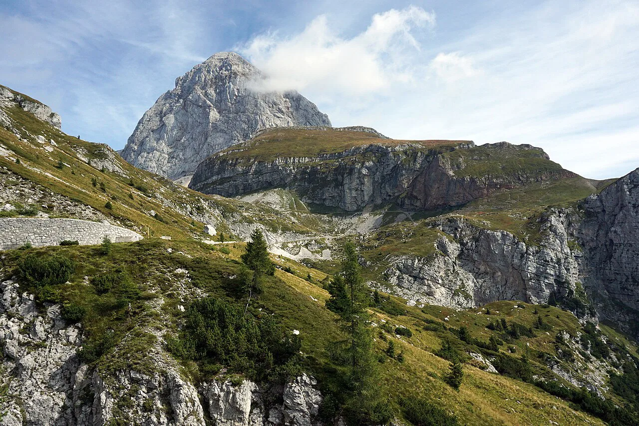
Approaching from Bovec, the road heads toward the Predel border crossing, and just after Strmec you turn right onto the marked road for Mangrtsko Sedlo, the saddle itself. The route climbs through a narrow, winding series of bends rather than a straight mountain highway. Allow more time than the distance suggests, especially if you meet oncoming traffic in the tightest sections.
If your wider trip covers several mountain areas rather than just this corner of the Slovenian Alps, it helps to see the saddle as one stop among many. The Soča valley below, Kranjska Gora to the north, and the passes around Vršič all sit within a compact radius. Build the drive around weather and visibility rather than a fixed checklist.
Getting there: the turnoff, the toll gate, and the climb
You will pass a toll gate on the way up, described as an ecological tax of approximately 10 euros per car. Budget for it in cash or however you normally pay road tolls. Carry some small notes for the gate.
From the gate the road continues climbing to the saddle, where a one-way loop sits above the Mangart Hut. Route notes for the saddle trails also list a parking fee of 10 euros, so plan for a possible additional charge beyond the road toll. Carry small notes and coins so payment does not hold you up.
This is one of the few places in the Slovenia mountains where a standard car gets you above 2,000 m with no walking at all, which is exactly why the road is busy in good weather. If that trade-off bothers you, arrive early in the day or treat the drive as a short visit rather than an all-day outing. The climb on foot from the valley, by contrast, takes hours.
Parking at the saddle
Parking is a designated area at the top of the loop, and the instruction that matters is to park legally inside it rather than pulling onto verges or blocking the turning space. The road is narrow enough that an obstructing car causes problems for everyone behind it. Walk the last stretch to your viewpoint instead of squeezing the car closer.
Because the loop sits above the Mangart Hut, you may want to walk down to it before heading back to the car. Keep that in mind when you decide how much gear to carry from the parking area. It is also a reason not to overpack the car for a quick stop.
What you see from the saddle
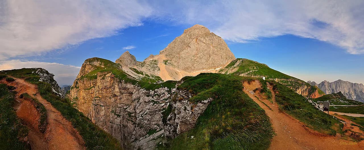
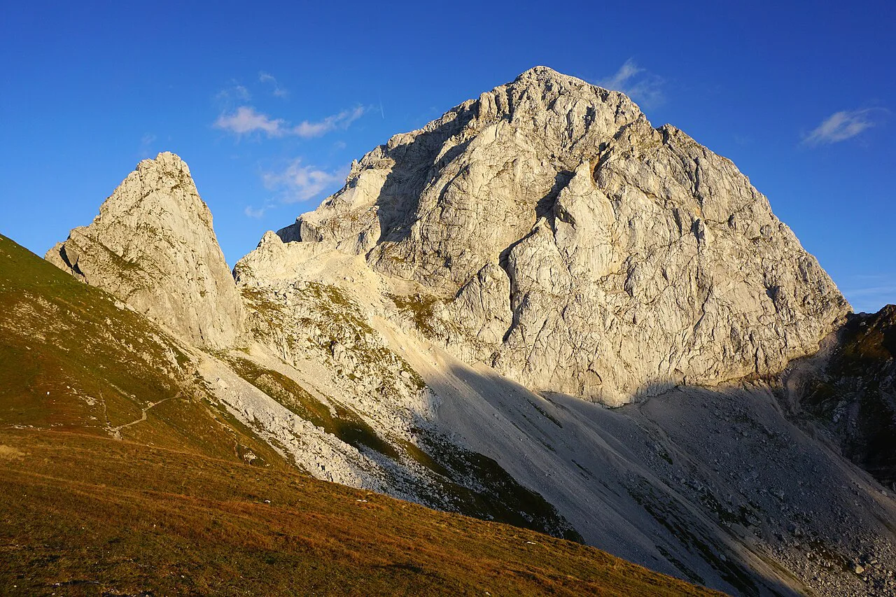
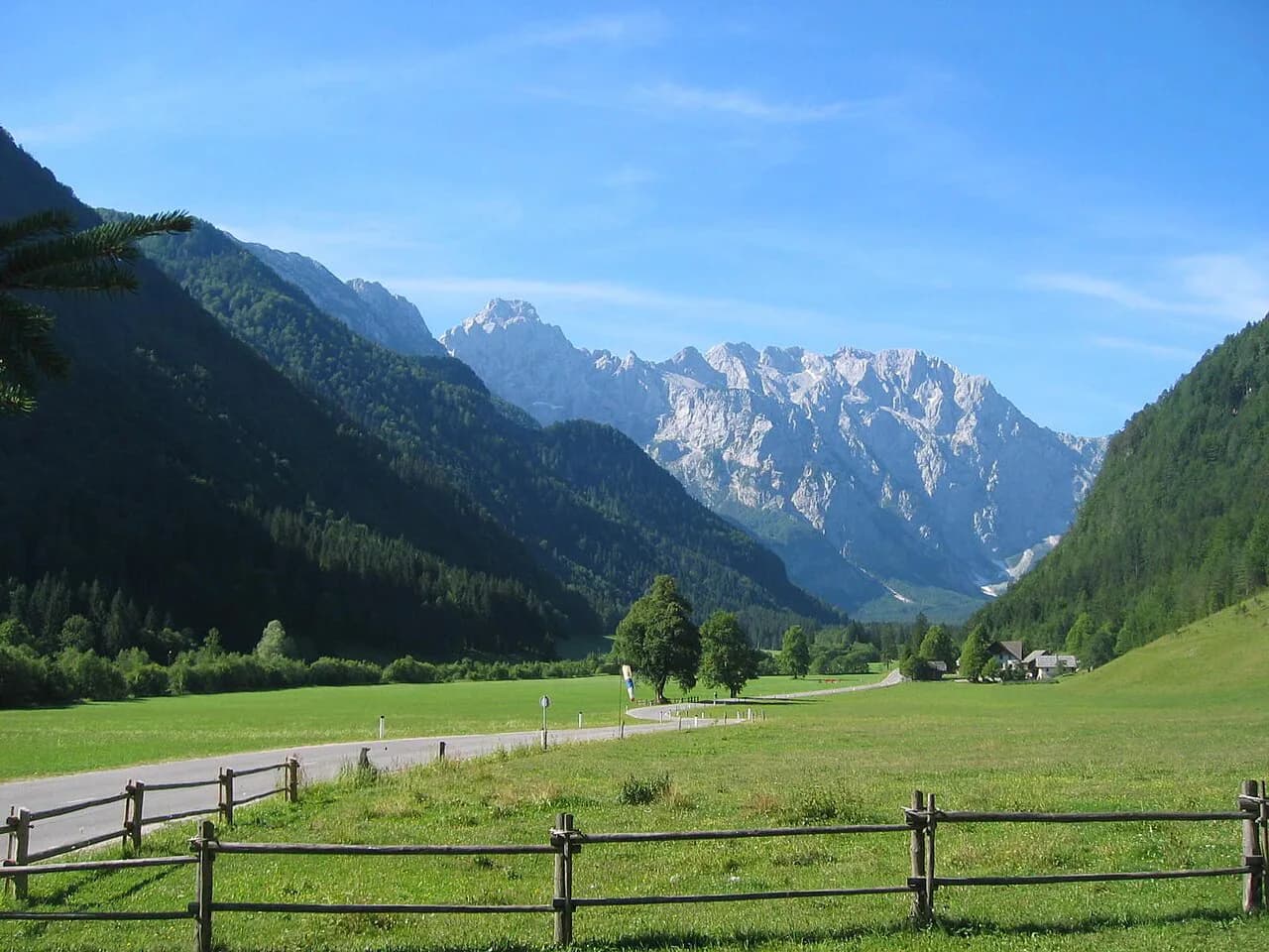
The saddle sits directly beneath Mangart's west face, and the view opens across the peaks above the Soča valley toward the Italian border country. On a clear day the panorama takes in Slovenian, Austrian, and Italian summits at once. That three-country sweep is the main reason to drive up even if you never leave the parking area.
Looking back down the approach, the Koritnica valley peaks and the road itself form the second half of the view. A hiking description of the saddle notes the prospect over Mangart and the Koritnica valley peaks, which is the angle most drivers photograph first. Give yourself twenty minutes simply to walk the loop and look in all directions before heading down.
One caution about published figures: the saddle appears in different listings at about 2,072 m, while the parking loop is given as roughly 2,055 m and the trailheads above the hut as about 1,850 m. These are not the same point on the mountain. Use them as orientation only, and read the elevation on your own map rather than trying to reconcile them.
Short walks and viewpoints for non-climbers
The simplest plan is to park, walk the saddle area, and follow the main footpath toward Mangart for as long as the ground stays comfortable. The marked junction near Mali Mangart is where the serious routes begin, so it works as a natural turnaround point for a stroll. Beyond it, the terrain stiffens quickly.
If you want a hill day without exposure, the saddle is still a sensible base: the drive does the elevation gain and you choose how much more to add on foot. Families and casual walkers should stay on the marked paths around the pass. Climbers heading for the summit need proper equipment and a clear head for loose rock.
If you want to go higher: Slovenska pot versus Italijanska pot
Two marked routes leave the saddle for the summit, and they are not interchangeable. The Slovenska pot branches right at the scree, alternating secured cable sections with long unprotected stretches over loose rock and dirt. It is graded B/C and demands confidence on crumbly ground.
The Italijanska pot, by contrast, is described as a demanding but technically simpler marked trail, and it is the usual descent. Do not come down the Slovenska pot: its loose rock and lack of continuous protection make it unsafe as a return. Climb one way and walk out the other.
Whichever line you take, the ascent from the saddle gains about 800 m and takes roughly two hours twenty minutes according to route notes. Add time for the descent and for waiting behind other parties on the protected sections. A helmet and a via ferrata set are not optional on the Slovenska pot.
Road and weather cautions
The Mangart Road is narrow, winding, and exposed to mountain weather, and access can change with conditions. Before you drive up, check current access information and plan enough time for the road itself, not just the stops at the top. Fog, rain, or early snow turn a scenic drive into a slow, demanding one.
The same applies to the routes above the saddle: do not attempt them in storms, heavy rain, or when ice and snow lie on the rock. Falling rock is a real hazard in both directions, from above and from what you dislodge yourself. Turn around early rather than pushing through deteriorating weather.
Plan the drive as a morning or a half day, not as filler between two other stops. The climb from Bovec, the stop at the saddle, and the descent back to the Koritnica valley use more of the day than the map implies. If the weather closes in, the valley towns and the Soča valley viewpoints make a reasonable fallback.
Practical budget notes
One cost applies on the way up: the ecological toll, given as approximately 10 euros per car. Route notes for the saddle trails also mention a 10-euro parking fee, though the amount and whether it is charged separately at the loop should be confirmed on the spot. Together they form the potential cash cost of the drive, before fuel and any food at the hut. Treat the amounts as approximate and check the current charge at the gate.
The road toll is described as per car; the parking fee, if collected, would likewise apply to the vehicle. Keep some cash available in case card payment is not an option at the gate or the loop.
Is the Mangart Road drive worth it?
Yes, if you want a high mountain view without a long hike, and you accept a narrow toll road and a paid parking loop at the top. The saddle gives you Mangart's west face and the Koritnica valley peaks within a short walk of the car, which is the whole point of the drive. Treat the summit routes as a separate decision that needs equipment and settled weather.
Check the current toll and parking amounts at the gate and at the saddle before you set out, and plan the drive as a morning rather than an afterthought. If you have time left in this part of the Slovenian Alps, the valley towns below make an easy second stop.
Explore more Slovenian Alps guides
Sources
Notes for your Slovenia trip
Optional updates to our Slovenia place guides.
You might also like
Continue reading
More guides you'll find useful