Mount Triglav: Slovenia's National Symbol and Where to See It
Mount Triglav is Slovenia's 2,864-meter national symbol inside Triglav National Park. Here is what it is, where it stands, and how to see it without the climb.
On this page
Mount Triglav is Slovenia's highest mountain at 2,864 meters, and it stands in the Julian Alps in the country's northwest, close to the Italian and Austrian borders. You do not need to climb it to understand why it matters: the peak is the national symbol, reproduced on the coat of arms and flag. This guide covers what the mountain is, where the surrounding park begins, and how to see the peak from the valleys, lakes and roads at its base without a summit attempt.
Triglav National Park covers almost the entire Slovenian part of the Julian Alps, and it is the only national park in the country. Protection began in 1924 with a reserve in the Triglav Lakes Valley, and the park today holds the source of the Soča River, glacial lakes, gorges and high mountain meadows. Treat the park as the frame around the peak: the mountain is the headline, but the lower ground is where most visitors spend their time.
What Mount Triglav Is and Where It Stands
The peak rises to 2,864 meters and is the highest point in Slovenia as well as the highest in the Julian Alps. It sits in Triglav National Park, which covers nearly all of the Slovenian side of the range along the border with Italy. The mountain is not a roadside sight: it is a summit in a protected alpine park, and the roads and valleys below it are the practical way to approach.
Distances are short in absolute terms. Ljubljana is roughly 80 kilometers away, or about an hour by car, Kranjska Gora is about 25 kilometers, and Bled is around 35 kilometers. Bovec sits further west at about 70 kilometers, roughly an hour and a half. That compact geography means you can base yourself at Lake Bled, Kranjska Gora or Bovec and still reach the trailheads and viewpoints around the mountain within a morning.
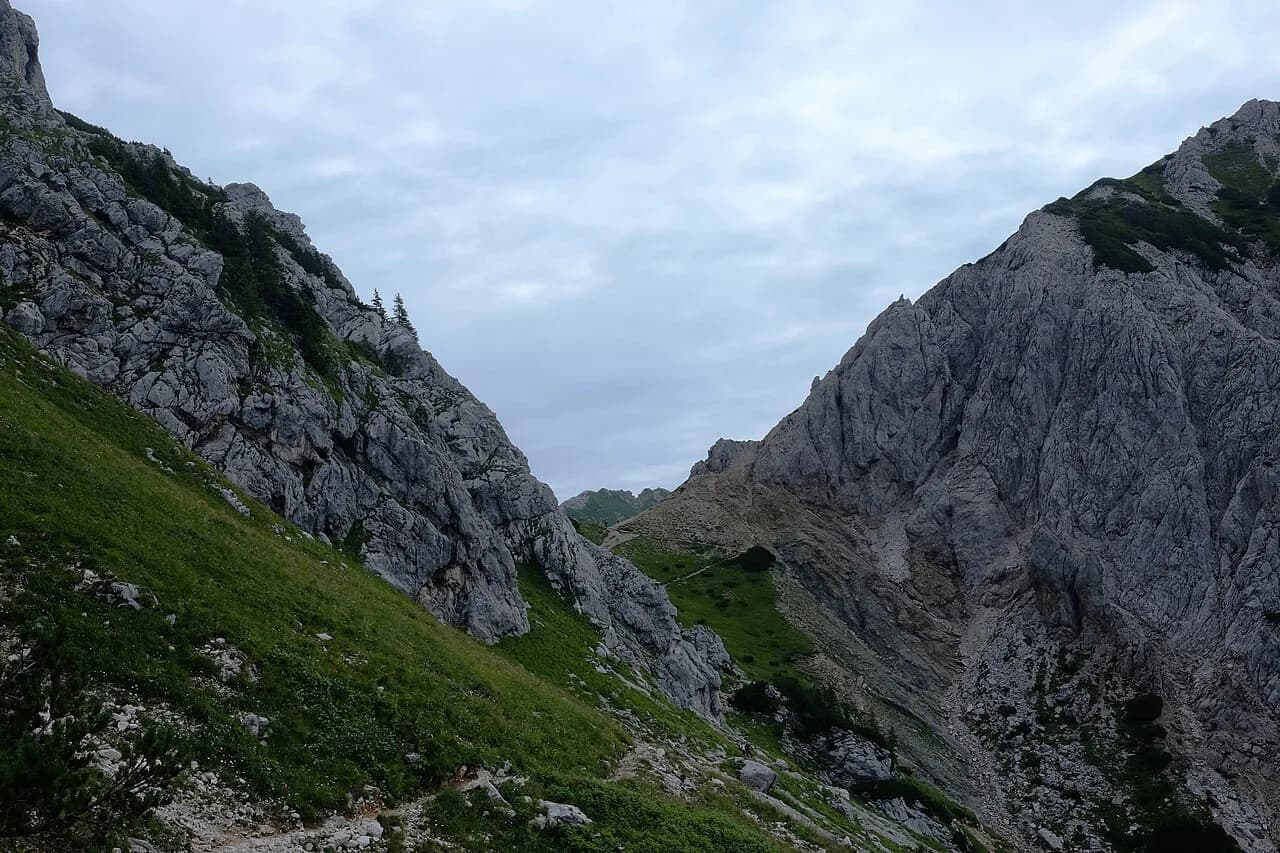
Four starting points lead toward the summit: the Krma Valley, the Vrata Valley, the Seven Lakes Valley above Lake Bohinj, and the Zadnjica Valley. Those names are useful even if you never go up, because they mark where the mountain's flanks meet the road network. If your plan is to look rather than climb, use them as orientation rather than as itinerary stops.
The Aljaž Tower and Why It Matters
A small metal cylindrical tower stands on the summit. It was brought to the top in 1895 by friends of the priest Jakob Aljaž, who had bought the peak to protect it, and it has since been declared a cultural and historical monument. The tower is the reason many photographs of the summit look the way they do: it is a built object on a natural high point, not a monument at ground level.
Triglav became a symbol of Slovenian identity from 1895 onward and, after independence, a symbol of the state. That is why the peak appears on the flag and coat of arms, and why the tower carries weight beyond its size. For a visitor who will not climb, the takeaway is simple: the mountain is a national emblem first and a hiking objective second.
Which Valleys, Lakes and Roads Frame the Peak
The Krma Valley offers the longest but easiest line toward the summit, a seven-kilometer trail, and it is the gentlest of the four approaches in terms of technical demand. The Vrata Valley holds the shortest route. Plan on walking rather than driving to the best angles, and give yourself more time than the map suggests.
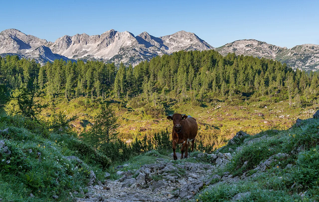
Lake Bohinj sits on the southern side of the massif, and the Seven Lakes Valley rises from near its shore. The lake itself is a low-effort place to orient yourself before heading higher, and the surrounding villages give you a base within the park rather than at its edge. If you want a single map to plan the loops around the lakes and valleys, start with a Triglav National Park map before you book anything.
The Pokljuka Plateau spreads northeast of Bohinj and is reached by road from Bled or Bohinj. It is high, wooded and open, with pastures and panoramic lines toward both lakes, and the peak stays visible as a backdrop. Come here when you want the mountain in the frame without a long approach, and bring a layer: the plateau sits well above the lake shore.
Where the Park's Entry Points Are and How They Connect
Road access runs around the park rather than through its center. Kranjska Gora anchors the north, Bovec the west, Bohinj the south and Bled the east, and the Vršič road links the Kranjska Gora side to the Soča valley across the middle of the range. That road is the single most useful connection for seeing the park without committing to a trail; check its current status before you rely on it.
On the western side, the Soča River runs through the Trenta Valley, where the river's source sits at the head of the valley. The park's official information centers are the natural first stop for orientation, exhibits and context before you drive further. From there, the road continues to Bovec, which serves as the western base for the upper Soča valley.
For a full picture of how these pieces fit together, the Triglav National Park guide covers the park's regions, bases and connections in more detail, and it makes a sensible next read after this page. If you are staying near Bled, the Pokljuka Plateau guide covers the plateau's roads and access points from that side.
What You Will See in the Park Below the Summit
The park's biodiversity is high for the Alps, a result of the geology and the meeting of alpine and Mediterranean climates. That mix produces rare flowers such as edelweiss, the Triglav rose and Zois' bellflower in rock crevices, along with forests, highland meadows, plateaus and peat bogs. Four flowers carry the Triglav name, including Potentilla nitida and Eritrichium nanum.
Wildlife includes chamois, ibex, mountain eagles, capercaillie and the marble trout that is endemic to the Soča River. The European watershed between the Adriatic and the Black Sea also runs through the park, which explains the density of streams and springs you pass. Watch from a distance and keep to marked paths; the animals here are wild, not park exhibits.
Water defines the lower ground: the emerald Soča, waterfalls, gorges and glacial lakes. Mostnica Gorge near Stara Fužina is about two kilometers long, cut by the Mostnica stream, with pools reaching up to 20 meters deep and a rock formation known as the Little Elephant. The walk through takes about an hour and a half in both directions, and the rock can be slippery after rain.
How Long the Lower Trails and Gorges Take
Budget by feature, not by ambition. Mostnica Gorge is a half-day at most at a relaxed pace, and the flat section near the water keeps it manageable for mixed groups. The Soča Trail is a different scale: it runs one way from the river's source to Bovec, with the official length at 25 kilometers but closer to 32 kilometers once you add the approach and detours.
Most hikers complete the Soča Trail in one day, close to ten hours of walking, though it can be split over two with places to stay along the way. A local bus runs from Bovec to the starting point and takes around 40 minutes. If you only have a day for the park's lower ground, pick one gorge or one stretch of river rather than trying to connect several.
Where to Base Yourself Around the Park's Edges
The practical bases are Kranjska Gora in the north, Bovec in the west, Bohinj in the south and Bled in the east. Each puts a different set of valleys within a short drive, so choose by which side of the massif you want to wake up on rather than by distance alone. Bled and Bohinj are the busiest in summer, while the Kranjska Gora and Bovec sides feel more spread out.
Several climbing operators arrange transfers from Bled, Bovec, Kranjska Gora and Ljubljana for summit trips, which tells you these towns work as pick-up points even if you are not climbing. Guided summit groups are usually small and fill early, so a two- to three-month lead time is sensible if that is your plan. The separate climbing guide covers routes and difficulty; this page stops at the valley floor.
Seeing Triglav Without the Summit
Decide first whether you want to see the peak or stand on it. If you want to see it, pick one base, drive to a valley or plateau on that side, and give yourself a half day for a gorge or a lake shore. If you want the summit, that belongs to a climbing plan with a guide, permits checked locally, and a two-day window; check current conditions and park rules before you commit to either.
Frequently Asked Questions
Which country is Triglav in?
Mount Triglav is in Slovenia, in the Julian Alps near the Italian and Austrian borders. The whole peak and its surrounding valleys sit inside Triglav National Park, the country's only national park, which covers almost the entire Slovenian part of the Julian Alps.
Is Mount Triglav hard to climb?
Yes, in the sense that it is a serious alpine objective rather than a walk. Even the most popular routes include steep, exposed sections, and the easiest approach begins with a via ferrata section of about 400 meters. Most climbers spread the ascent over two days with a night in a mountain hut, and a guide is the sensible choice without alpine experience.
What are the must-sees in Triglav National Park for someone not climbing?
The Vrata Valley and Krma Valley for valley-floor views, Lake Bohinj and the Seven Lakes Valley on the southern side, the Pokljuka Plateau for open pasture and long sightlines, and Mostnica Gorge near Stara Fužina for a short, wet walk. On the western side, the Trenta Valley and the source of the Soča River anchor a separate day.
Sources
Notes for your Slovenia trip
Optional updates to our Slovenia place guides.
You might also like
Continue reading
More guides you'll find useful