
Gozd Martuljek: Alpine Village at the Foot of the Martuljek Group

Gozd Martuljek is the village you drive through on the way from Jesenice to Kranjska Gora, and it is the practical starting point for the two Martuljek waterfalls — the Lower falls and the much more dramatic Upper falls under the Martuljek group. Treat it as a half-day base for the falls and Jasenje alpine meadow rather than a substitute for staying in central Kranjska Gora. This guide covers the village layout, the marked route up to the falls, the closed gorge path, Jasenje and Srednji Vrh, plus getting there, parking at the trailhead and where to eat and sleep.
Where Gozd Martuljek sits in the Sava Dolinka valley
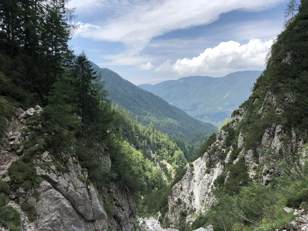
The village spreads along the Sava Dolinka and the main road between Jesenice and Kranjska Gora, with the Martuljek group rising directly to the south. The centerpiece is the slender rock pyramid of Špik, which gives the group its distinctive profile from the valley floor, and the water running down from below it threads the settlement with several waterfalls. According to the Kranjska Gora tourism organization, the area is a mix of unspoiled alpine nature and ethnographic heritage, and summer visitors come mainly for the falls and walking, while in winter the torrents below the slopes freeze into an ice curtain used by ice climbers.
The official village description is short on facilities, so plan the day around what the terrain offers rather than expecting a resort center. There is no published visitor infrastructure beyond the trailheads and the alpine farm, so bring what you need before you leave Kranjska Gora or Jesenice. A measured trail record puts the one-way walk at 2.76 mi, useful as a check against your own pace.

Who the village suits, and who should stay in Kranjska Gora
Gozd Martuljek suits travelers who want the Martuljek waterfalls as the day's main objective and prefer a valley village to a resort base. Walkers who reach the falls, return via Jasenje meadow and finish at the alpine farm get the most out of a stay here, and drivers can position themselves a few minutes from the trailhead. If you want a full set of restaurants, shops and accommodation within a few streets, Kranjska Gora is the better base. This guide covers the villages of the Kranjska Gora area separately, so you can pick the base that matches your day; see the Kranjska Gora Neighborhoods: 4 Area Guides for the alternatives.
The village also works for a short stop on a drive toward Vršič Pass or Podkoren, since the trailhead sits just off the main road. Travelers without a car should weigh the walk from Kranjska Gora along the valley road. If you prefer a smaller alpine village with its own character and easy access to the border country, Podkoren is another option worth comparing before you book.
Village layout: the bridge, the turnoff and the trailheads
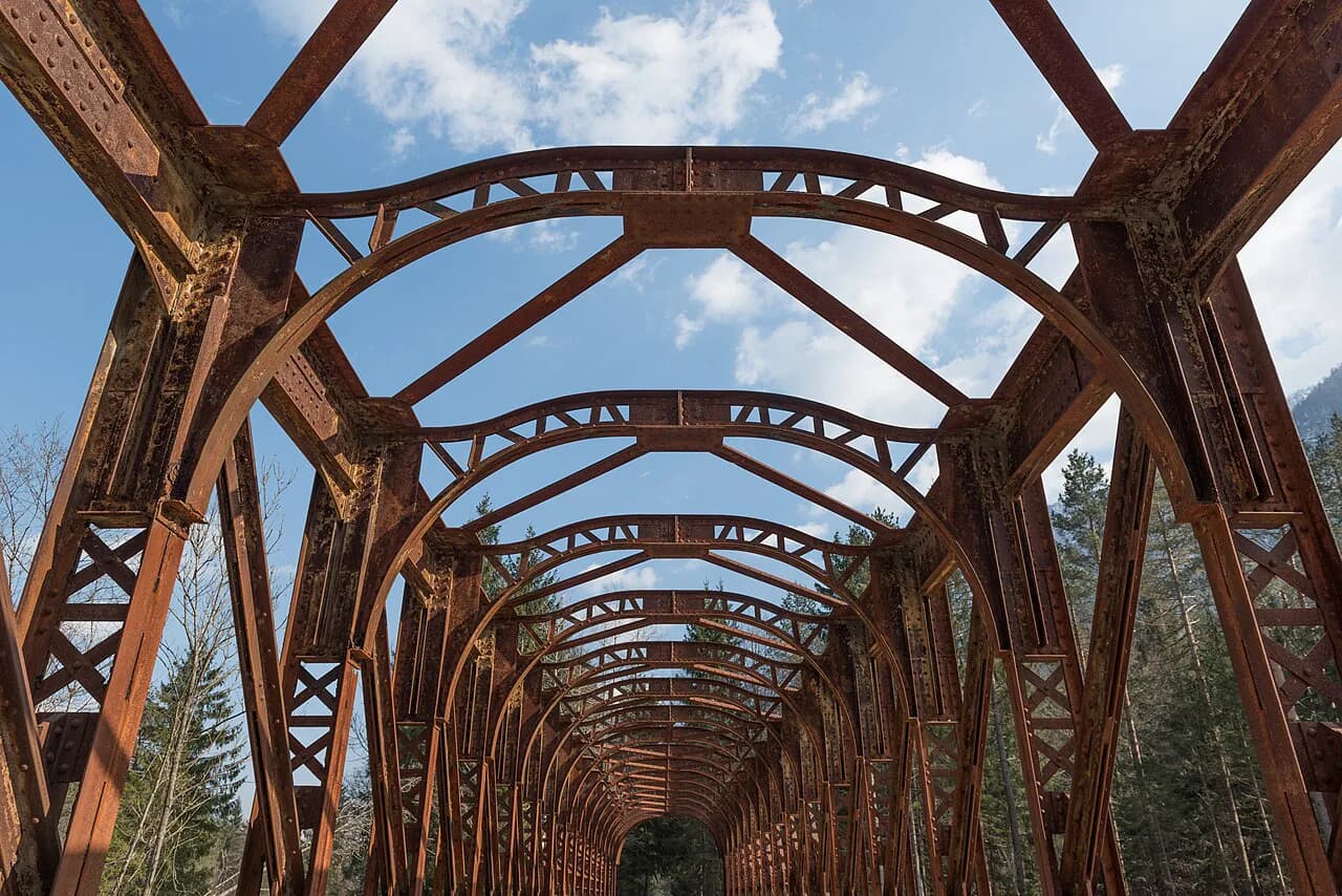
The village is laid out along the main road, and the key landmark is the bridge over the Sava Dolinka at Gozd Martuljek. Coming from Jesenice toward Kranjska Gora, the road turns right just after this bridge, and the parking area for the falls sits on your left immediately behind that turn. Leave the car there rather than trying to find a space further up.
From the parking lot, walk a few meters along the main road toward Kranjska Gora and turn left onto the asphalt cycling path. Follow it briefly, then continue straight onto the forest road, keeping to the signposts for Martuljški slapovi or Brunarica Pri Ingotu at every junction. The trail is marked, so the main navigation task is choosing the right branch at the meadow with the charcoal-making information boards.
The Martuljek waterfalls: Lower and Upper falls
The route reaches two distinct waterfalls, and it helps to plan them as separate stops. From the marked crossroad above the meadow, a left turn leads down a narrow footpath to Lower Martuljek waterfall in about 5 minutes, where the ground calls for some care. Return to the main track, then continue upward toward the signpost for the second fall.
Upper Martuljek waterfall drops across a 100 m vertical wall in several stages, and the amphitheater below it opens up after roughly another half hour of walking. Reaching the small pool directly beneath the fall means climbing an extremely difficult passage secured with steel cables and stemples, which is appropriate only for skilled mountaineers. Everyone else should enjoy the view from the marked path and turn back the same way.
The figures for the full falls walk are 8 km, 470 m of ascent and about 2 hours, on a non-demanding marked path except for the very demanding last section to the second waterfall. Treat these as route figures rather than a promise for your own pace, since the steep ground near the falls slows most people down.
The closed gorge path and the signed route via Pri Ingotu
At the meadow with the charcoal boards, the path splits. The branch through the Martuljek gorge is closed because the terrain above the gorge is very crumbly and causes persistent trouble for the path's keepers. Do not treat the closure as covering the whole route: the signposted line via Brunarica Pri Ingotu is the recommended alternative.
Take the signpost for Brunarica Pri Ingotu and start up a wide but rather steep tractor road, reaching a marked crossroad in about half an hour. From there the Lower falls detour and the upper route both branch off, and on the way back the Pri Ingotu signpost sends you right, across a stream and past a wooden chapel to Jasenje meadow. Follow the same line down to the valley.
Jasenje alpine meadow and the alpine farm Pri Ingotu
Jasenje alpine meadow is the natural lunch stop between the two waterfalls, and the alpine farm Pri Ingotu serves home-made food there. If you are already tired at the crossroad in front of the meadow, a left turn brings you to the farm in a few steps instead of continuing to the upper fall. This makes the farm a sensible turnaround point on a short or weather-shortened day.
Srednji Vrh and the view back to Špik
Srednji Vrh sits across the valley in the Karavanke range, and the Kranjska Gora tourism organization names it as the best viewpoint for the Martuljek group. If you want the wide shot of Špik and the surrounding walls rather than the close view from under the falls, add this to your drive instead of the walk. The village's house names date from the period of Ottoman raids, which is a small piece of local color rather than a reason to visit on its own.
Getting there and around: driving, parking and walking
By car, approach from Jesenice along the Sava Dolinka valley toward Kranjska Gora and watch for the bridge at Gozd Martuljek, then the right turn and the parking lot on the left. Parking is at the trailhead, so the walk starts and ends at your car; arriving early leaves you more room to maneuver. There is no published shuttle for the falls, and the cycling path from the village is a separate route rather than a transfer service.
On foot from Kranjska Gora, the valley road connects the two settlements, and the falls trailhead is reached from the village side of the bridge. Walking in and out adds distance to the 8 km loop figures, so budget accordingly if you have no car. For other bases in the area, Rateče: An Alpine Village at the Corner of Slovenia sits further up the valley near the Italian and Austrian borders.
Where to eat and sleep in and near the village
Eating options in the village itself are thin on the published record, with the alpine farm Pri Ingotu on the falls route as the clear sit-down stop for home-made food. For a broader choice of restaurants and beds, base in Kranjska Gora and drive the few minutes to the trailhead. Several guesthouses and apartments around Kranjska Gora appear as nearby places to sleep on the falls route listing, including House Neža, Apartments Vijolica and Design Rooms Pr Gavedarjo.
What to know before you set out
The path is easy in its lower stretches but turns steep close to the waterfalls, and the final section to the Upper falls pool is a secured climbing passage with cables and stemples. Wear shoes with grip, keep an eye on the crumbly ground above the gorge, and turn around if the rock is wet. The falls sit at about 1200 m, so the weather can differ from the valley floor.
Check the official Kranjska Gora tourism site for current conditions before a falls day, especially after heavy rain, and confirm locally that the gorge branch remains off-limits. Guided hiking options across the Julian Alps are also sold as day tours from the Gozd Martuljek area if you would rather not navigate the junctions yourself.
Is Gozd Martuljek worth the stop?
Yes, if the Martuljek waterfalls are on your list. The village gives you a trailhead of its own, a signed route that avoids the closed gorge, and a lunch stop at Pri Ingotu on Jasenje meadow. Plan two hours for the 8 km route, add time for the Lower falls detour, and skip the steel-cable passage to the Upper falls pool unless you climb.
If you want the falls without the driving, sleep in Kranjska Gora and walk or drive over; if you want more village life, Podkoren is the other small base in the valley worth comparing. Either way, start early and treat the upper fall as a viewpoint rather than a scramble.
Explore more Kranjska Gora guides
Frequently Asked Questions
Do you need a ticket for the Martuljek waterfalls?
The falls route is a marked mountain path starting from a roadside parking area; the route listing gives no entrance fee and describes no ticket booth or timed entry. Bring cash for food at the alpine farm on Jasenje meadow and check the official Kranjska Gora tourism site before setting out.
How long does the Martuljek waterfalls walk take?
Allow about two hours for the 8 km route with 470 m of ascent, plus the short detour down to Lower Martuljek waterfall. The steep ground near the falls and the stop at Pri Ingotu usually stretch that figure.
Can you reach the pool under Upper Martuljek waterfall?
Only by climbing an extremely difficult passage secured with steel cables and stemples, which suits skilled mountaineers. Most visitors should stay on the marked path and view the fall across the rocky amphitheater.
Is the Martuljek gorge path open?
The branch through the Martuljek gorge is closed because the terrain above it is crumbly, so take the signposted route via Brunarica Pri Ingotu instead. That alternative is the route the walk relies on while the gorge path stays shut.