
Rateče: An Alpine Village at the Corner of Slovenia

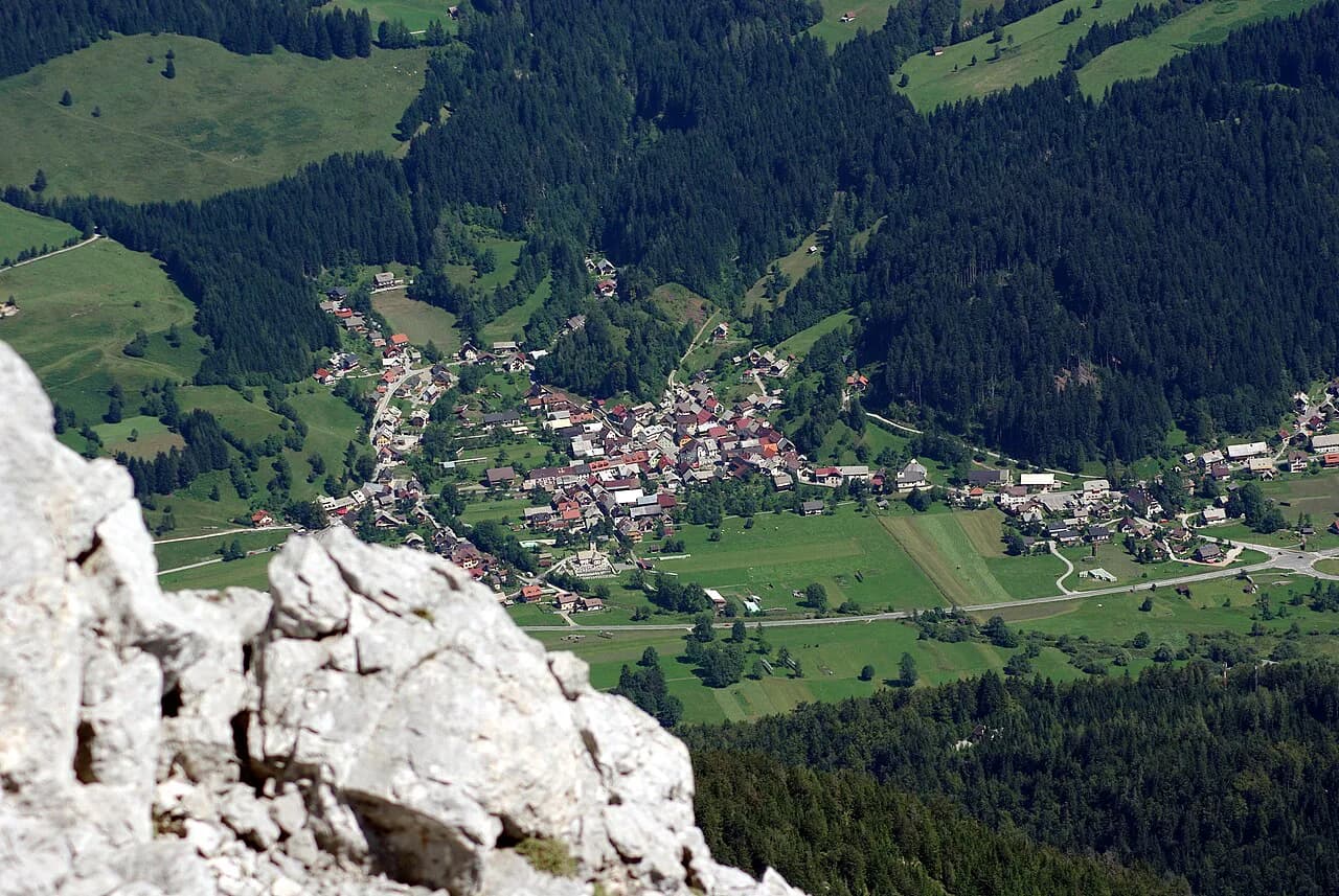
Rateče is the last proper village before Slovenia's borders with Italy and Austria, roughly 870 meters above sea level in the Upper Sava Valley near Kranjska Gora. It makes sense as a half-day stop or a quiet base if you have a car or bike, not as a stand-alone destination for a whole trip. This guide covers the village layout, its sights, the walks and rides that start from it, and where it sits among the Kranjska Gora Neighborhoods.
What Rateče is and where it sits
Rateče sits on a sunny shelf of meadows just off the main road west of Kranjska Gora, and the Sava Dolinka rises a short walk away at Zelenci. The village tourism association places it at 870 meters and describes it as close to both the Italian and Austrian borders, which is the key to how it feels: you can see neighboring countries from the surrounding slopes.
The village is small enough to cross on foot, with the church square at its center and lanes spreading out toward the meadows. Everything else in the area, from Planica to the lifts at Kranjska Gora, requires a short drive, a bike ride or a bus.

Who Rateče suits, and who should stay in Kranjska Gora
Rateče suits travelers who want quiet evenings, mountain views from the doorstep and a short hop to Zelenci, Planica and the Tamar Valley. It is also a sensible base for anyone crossing into Italy or Austria by bike, since the marked trail leads west past the border toward the Mangart Lakes and travelers should carry ID for that stretch.
If you want restaurants, shops and lifts within walking distance, Kranjska Gora is the better base; the village has a few inns and guesthouses but not the town's range. Use our Kranjska Gora Neighborhoods: 4 Area Guides to compare Rateče with Podkoren, Gozd Martuljek and Mojstrana before you book.

The village layout
Rateče is organized around its church and the open square in front of it, with older farmhouses and lanes running off toward the fields. The tourism association lists a very old church with a square in front of it among the heritage buildings you pass on the way through, and the cycle route into Kranjska Gora takes you past similar old houses and Liznjek's house, the local museum.
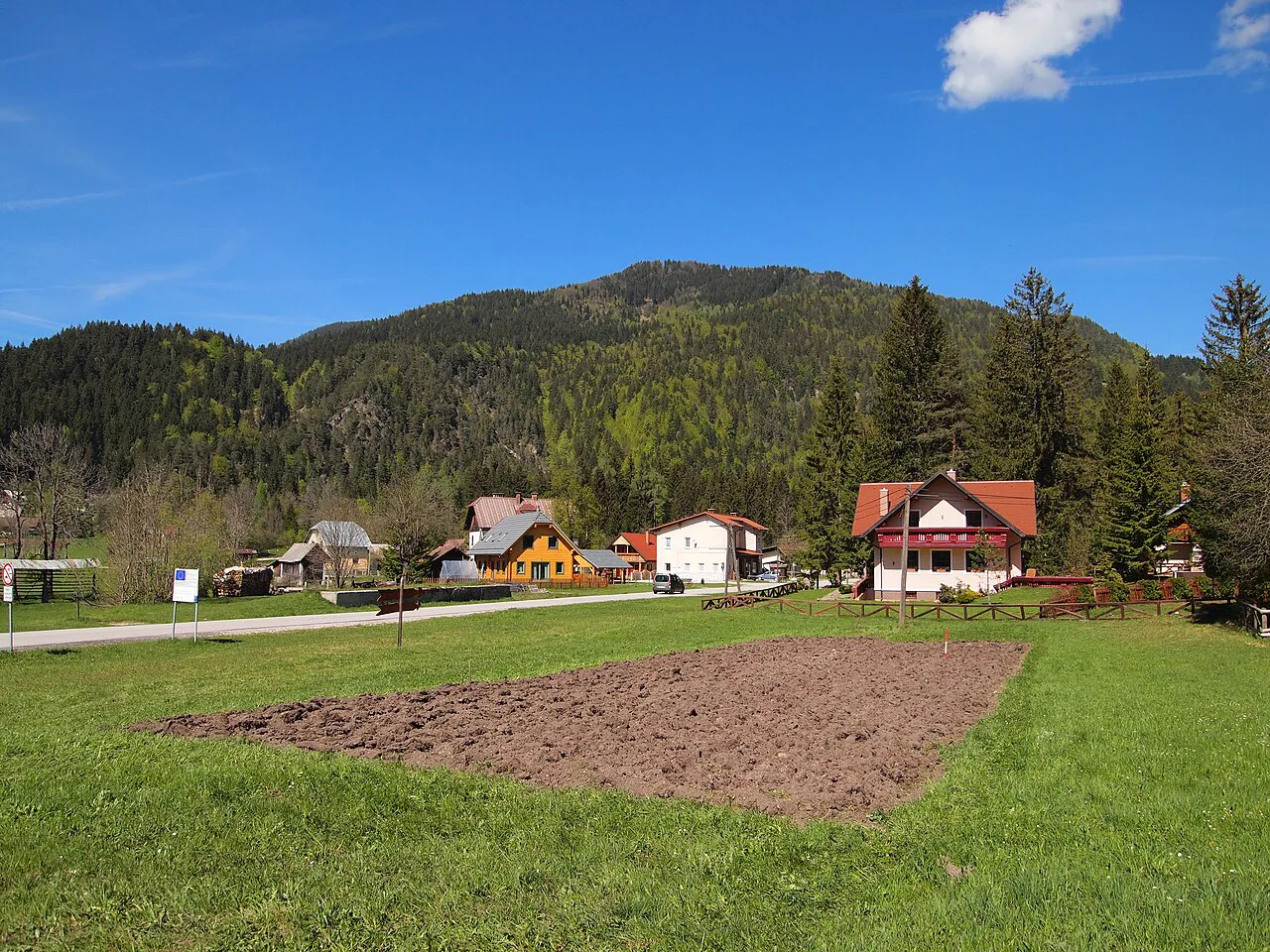
The surrounding meadows are the reason to linger, since the village is set among green fields with the Julian Alps on one side and the Karavanke on the other. Walk five minutes in almost any direction and you are out of the built-up area, which is what makes the place feel so open.
Kajžnkova hiša and the Ethnological Heritage of Rateče
Kajžnkova hiša houses a permanent collection on Rateče's local history, the village costume, food traditions and customs. In its rooms the collection displays both the festive and the everyday version of the Rateče costume, one of the few Slovenian costumes that residents still keep and occasionally wear.
A newer film about the costumes is also shown in the house and presents the dress on screen, while the festival and the village day remain the occasions when residents wear it in the street. Tour times and admission are not something to guess at, so confirm them with the tourist information office in Kranjska Gora before you build a day around it.
The Rateče costume and žoki footwear
The žoki are the village's original winter footwear: the inside is woven from local wool, the outside is covered with fabric and the sole is leather. Women from the village demonstrate the whole process of preparing the wool, embroidery and making the shoes during Vaški dan, the village day in Rateče, which is the occasion to see them made rather than just displayed.
Vaški dan is also when residents wear the costume in the street, so if the craftsmanship is the point of your visit, time your trip around the village's own event calendar rather than hoping to catch a demonstration by chance.
Zelenci Nature Reserve and the source of the Sava Dolinka
Zelenci lies between Rateče and Podkoren, just off the main road, and a marked footpath leads from the roadside parking area to the small blue-green lake that is the source of the Sava Dolinka. Beyond the pool the water spreads into an extensive marsh, and the area has been a nature reserve since 1992, with unusual plants such as the carnivorous rosika and rare animal species.
Plan the visit as a short walk of under an hour rather than a hike, and wear shoes that cope with damp ground around the marsh. The reserve sits between Rateče and Podkoren, so it pairs naturally with either village; see our Podkoren guide for the other approach to the reserve.
Farther east, the same river corridor runs down past Gozd Martuljek toward Mojstrana, which is useful if you are plotting a valley day by bike rather than by car.
The Three Countries Border at Peč
The Three Countries Border sits on the slopes of Peč above the village, where Slovenia, Italy and Austria meet, and a wood path runs up from the Šurc Inn past meadows to the crossing point. A monument was erected there in 1994, dedicated to understanding and friendship among the three nations, and the viewpoint opens over the surrounding valleys, villages and mountains.
The walk is uphill on a forest path, so give it more time than a flat village stroll and carry water. Border formalities change, so if you plan to continue into Italy or Austria on foot or by bike, check the current rules with the tourist information office before setting out.
The Chapel of Our Lady of Good Help
The Chapel of Our Lady of Good Help was built in 1936 on the initiative of the then parish priest Josip Lavtižar and renovated in 2002 under Marko Benedik, with mosaics by Marko Ivan Rupnik and assistants from Centro Aletti in Rome. The mosaics are the reason to pause at the chapel, which is a small, quick stop on a village walk rather than a sight in its own right.
The tourism association records a church service on Sundays in July and August at 3 pm, which tells you when the chapel has been in use; treat that as a record of past practice and confirm the current schedule locally if attending matters to you.
Cycling from Rateče
The bike trail from Rateče toward Kranjska Gora follows the former railway line, is asphalted and runs through quiet surroundings away from the main road traffic, with places to stop for a rest and refreshments on the way. It continues past the chairlifts through Kranjska Gora toward Gozd Martuljek, about 3 kilometers beyond the town, and eastward it is signposted all the way to Mojstrana.
That makes the old railway line the low-traffic way to reach Kranjska Gora without a car, and a realistic outing for casual riders. If you want to continue east, our Mojstrana guide covers where the trail ends and what is around it.
Rateče as a gateway to Planica and the Tamar Valley
Planica lies just east of Rateče, and the Planica valley continues up into the Tamar Valley, which the tourism association describes as the starting point for serious mountaineering in the Julian Alps, with the Tamar Mountain Hut at the foot of the mountain walls. For a non-climber, the valley is a place to drive to, walk a little and look up, rather than a destination requiring technical gear.
Combine Planica with Zelenci on the same afternoon, since both sit within a few minutes' drive of the village. Ski jumping and the chairlift at Kranjska Gora operate on their own seasons, which the local tourist office can confirm for your dates.
Eating in Rateče and nearby Podkoren
Eating options in the village are limited to inns and guesthouses, and the Šurc Inn is the one the tourism association names as the start of the Three Countries Border walk. For a wider choice of restaurants, pubs and inns, the trail description points to Kranjska Gora itself, a short bike ride or drive away.
Nearby Podkoren, between Rateče and Kranjska Gora, is another option on the same road, and our Podkoren Kranjska Gora guide sets out what is there. Menus and hours change with the season, so call ahead if you are arriving late.
Getting to Rateče and crossing the borders
By car, Rateče is a short run west of Kranjska Gora on the main road, with the Zelenci parking area just off it and the village center a little further on. By bike, the old railway line path connects Rateče with Kranjska Gora and onward to Gozd Martuljek without mixing with traffic, which makes it a calm and straightforward approach if you are staying in town.
The tourism association notes that ID documents are needed on the bike route west of Rateče toward the Mangart Lakes in Italy, so carry a passport or ID card if you plan to cross. Bus timetables in the valley are seasonal and thin, so confirm departures locally rather than assuming a regular service.
Where Rateče fits in a two- or three-day plan
Give Rateče half a day for the village, Kajžnkova hiša and the chapel, and add Zelenci and the Three Countries Border walk if the weather holds. A second day can take in Planica and the Tamar Valley or a bike ride along the old railway line into Kranjska Gora and on toward Gozd Martuljek.
The honest trade-off is that Rateče is quiet and spread out, and most of the bigger draws in the valley, including Lake Jasna and the Vršič Pass road, need a car, bike or bus to reach. Treat it as a peaceful base with good access rather than a village where everything is on the doorstep.
Should you base yourself in Rateče?
Choose Rateče if you want quiet nights, meadows out the door and quick access to Zelenci, Planica and the border paths, and if you have a car or bike to cover the rest of the valley. Choose Kranjska Gora instead if you want restaurants, shops and lifts within walking distance and do not want to drive in the evenings.
Whichever you pick, check the tourist information office for the current Kajžnkova hiša arrangements and any border rules before you travel, then build the rest of the day around the walks that start right in the village.