Vipava Valley: What to See, How It's Laid Out, and How to Plan a Drive
Plan a Vipava Valley drive: the springs in Vipava, walled Vipavski Križ, the Roman fort in Ajdovščina, and Rihemberk Castle above Branik.
On this page
Plan the Vipava Valley as one west-to-east line of stops: Nova Gorica at the Italian border, then Ajdovščina and Vipava in the middle, then Branik and Rihemberk Castle toward the eastern end. A full day covers the towns comfortably; a half day gets you Vipava and Vipavski Križ with time to walk. This guide covers the layout, the drive in from Ljubljana, what you can park at, and the honest time cost of the hill detours.
Vipava Valley at a glance: what it is and how the pieces fit together
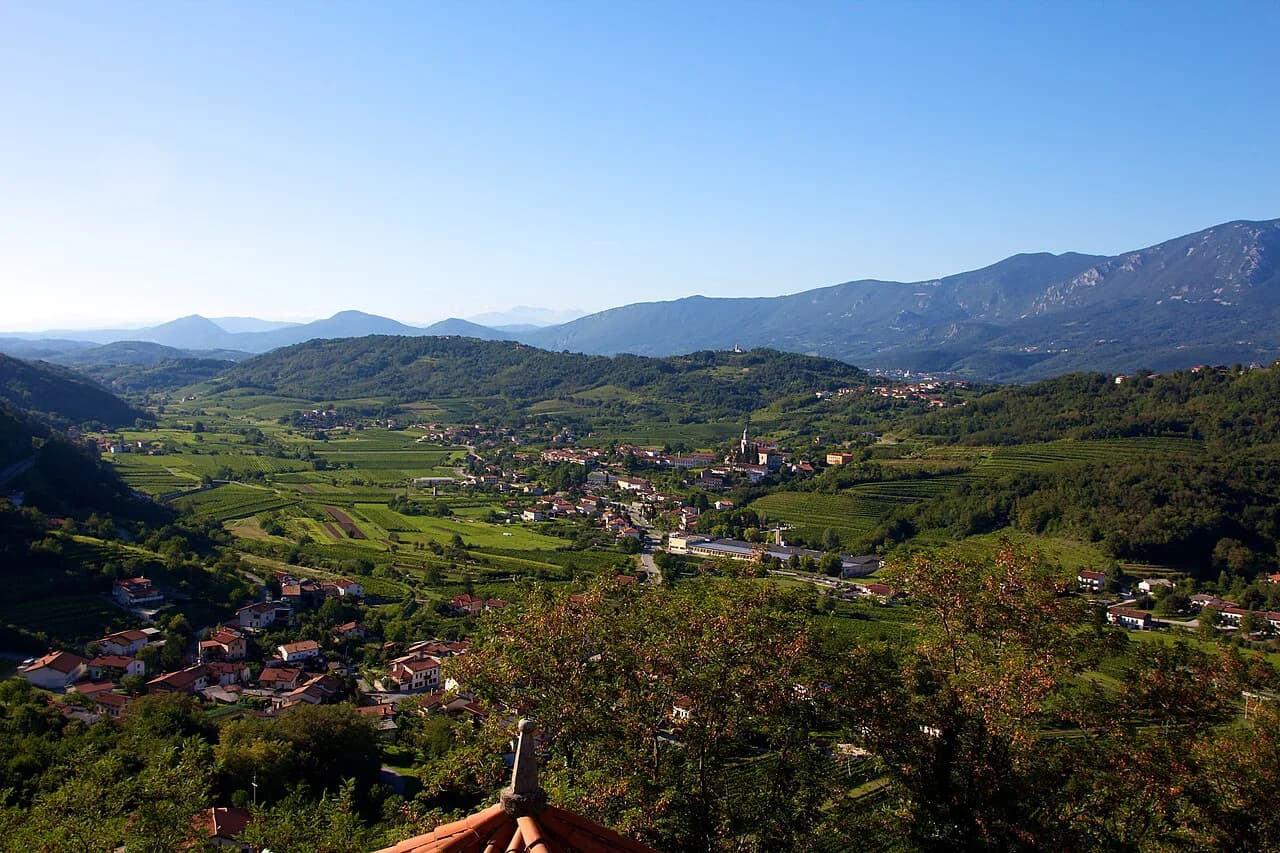
The valley runs across Slovenia's southwest corner, wedged between the Trnovo Forest Plateau to the north and the Karst Plateau to the south, with the River Vipava surfacing in the middle. That position gives it a mild Mediterranean microclimate and the fierce burja wind, which shapes both the vineyards and how a day outdoors feels. Treat it as a corridor: everything sits along one axis, so you drive through rather than loop around.
The towns reward a slow walk, the hills reward half a day each, and you cannot do both in one afternoon. Decide before you leave whether the day is built around villages or around one viewpoint.
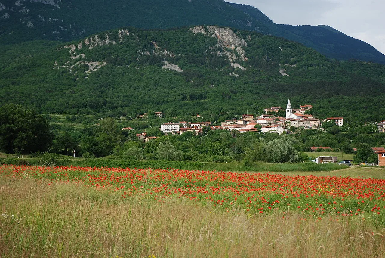
Where the valley sits: Ljubljana, Nova Gorica, and the Karst edge
The valley lies less than an hour's drive from Ljubljana and stretches west to the Italian border, which makes it one of the easier non-Ljubljana regions to slot into a trip. Nova Gorica sits at the western end, close to the River Soča and at the terminus of the railway line from Ljubljana. That rail link matters: the western gateway is reachable without a car, even if the villages in between are not.
Nova Gorica is the practical base and the natural first stop, with leafy parks, postwar architecture, and a cluster of bars and restaurants for the evening. It shares a border and a history with Gorizia in Italy, and the two towns were built around the idea of a cross-border city. Use it as the anchor for the western end of your day rather than rushing through.
If you arrive from the coast or the Karst, you come in from the south rather than the east, so the sequence reverses: Branik and the castle first, Vipava last. The valley also borders the Goriška Brda hills to the northwest, a separate wine district that deserves its own day rather than an hour tacked onto this one.
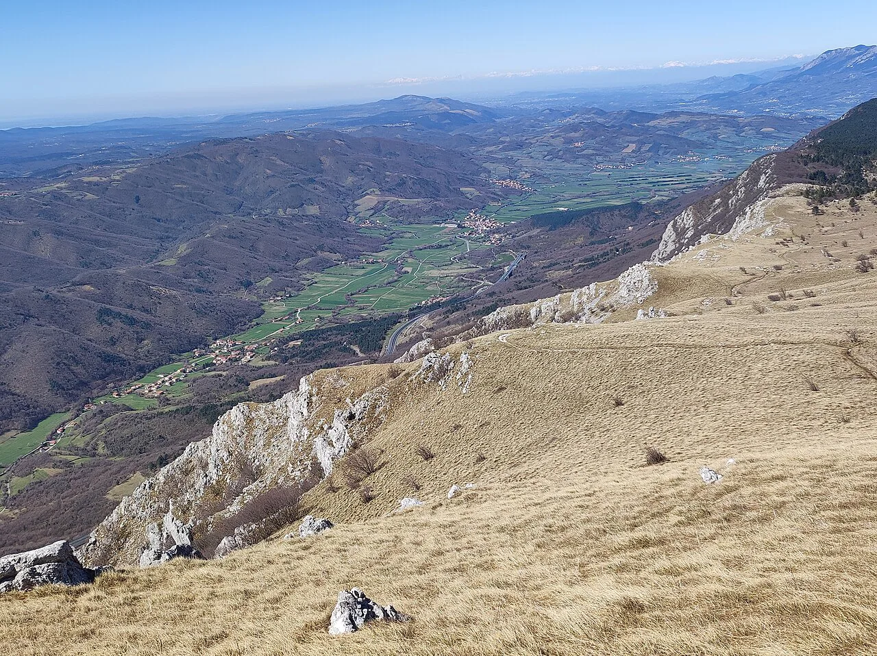
Drive or train: getting in from Ljubljana and using Nova Gorica as a gateway
Assume a car: the towns are close together but the spaces between them are vineyards and back roads, and the hill detours have no rail alternative. The minor roads carry light traffic, which is why cycling is a realistic way to link the villages if you have the legs for it. Rent bikes or e-bikes in the valley if you want to cover Vipava and Ajdovščina without moving the car twice.
The train from Ljubljana ends at Nova Gorica, at the western edge of the valley. That works if Nova Gorica is your base and you plan to walk the town, but it does not put you in Vipava or Ajdovščina, so plan a bus, taxi, or bike for the middle section. The valley's tourism portal lists guided tours, sports equipment rental, and transfer and shuttle services, which is where to look for local arrangements.
Cross-border rail is worth knowing about if you are combining Slovenia and Italy, since curated train journeys link the two countries through this region. For the eastern end, around Branik, assume you need the car.
The layout: Nova Gorica in the west, Ajdovščina and Vipava in the middle, Branik to the east
Picture a line: Nova Gorica at the border, Ajdovščina as the second town eastward, Vipava next, and Branik with Rihemberk Castle above it toward the eastern end. Vipavski Križ sits between Ajdovščina and Vipava, which makes it an easy stop on the way rather than a separate trip. Base in Ajdovščina or Vipavski Križ and you are in the middle of that line with both ends within reach.
This sequence is why a single day works: you do not backtrack, you drive east through the stops and end at the castle, or reverse it coming from the east. The one thing that breaks the line is a hill detour, since both Otliško okno and Nanos take you north and up.
Vipava town: the delta-shaped springhead, water channels, and the tree-lined square
Vipava is built on a delta-shaped riverhead, where the River Vipava emerges from multiple karst springs below the Nanos hills. Water channels and bridges thread through the center, and the main square is broad and tree-lined, a good place to start and finish. Allow an hour to ninety minutes on foot, more if you sit down for lunch.
The local white grapes include the indigenous Zelen and Pinela, though this is not a tasting guide. In the cemetery you'll find a pair of Ancient Egyptian sarcophagi, an oddity that pairs naturally with a circuit of the channels. It is the most rewarding single stop in the valley for a short visit, because the springs, channels, and square sit within minutes of each other.
Vipavski Križ: the walled village of stone houses
Vipavski Križ is a cluster of stone houses wrapped inside medieval walls, small enough to walk in twenty minutes without rushing. Its appeal is the enclosure itself: you enter, the walls close behind you, and the village reads as one piece rather than a street of separate sights. Stop on the way between Ajdovščina and Vipava rather than routing to it specially.
It is also a usable base if you want the middle of the valley rather than Nova Gorica, with the towns, trails, and vineyards within easy reach. Pair it with Vipava in the same half day.
Ajdovščina: the Roman fort of Castra and the preserved Roman wall
Ajdovščina holds the Roman fortress of Castra, and the town's tourism portal runs guided walks through the ruins and along what it describes as the longest preserved Roman wall in Slovenia. That guided format is the clearest way to make sense of the site, since ruins without context are just stones. Give the town an hour, or two if you join the Castra walk.
The town is the second largest in the valley and works as a practical stop for supplies and a walk rather than a destination in itself. Families traveling with children may note the Škrateljc forest path by the River Hubelj, with interactive stations, stamps, and a secret word to assemble. From Ajdovščina a well-marked trail climbs to Otliško okno, where the hill detour begins.
Rihemberk Castle above Branik and what a hilltop ruin stop involves
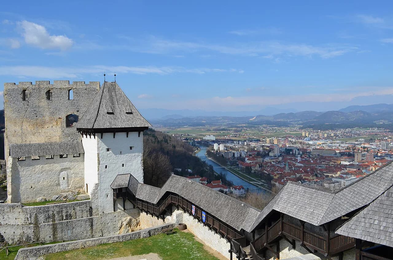
Rihemberk Castle sits on a hilltop above Branik at the eastern end of the valley, a sprawling building with the tallest tower in Slovenia according to CNN. It dates from the 13th century and was added to over the following centuries. The draw is the position: you see the castle above the village long before you reach it, and the walk up is part of the visit.
Plan this as a hilltop stop, not a drive-by: park in Branik and allow time for the climb and the wander around the walls. Confirm current access and any guided arrangements with the valley's tourism portal before you build the day around it, then work backward from the castle as the eastern anchor.
Otliško okno and the Trnovo Forest Plateau edge
Otliško okno is a natural rock window in the limestone, roughly 40 feet high and shaped like a giant teardrop, framing the valley below. A well-marked trail leads up from Ajdovščina, and the walk takes around 90 minutes to reach the window, a walking estimate you should stretch for your own pace and photo time. From the window you can continue to a mountain guesthouse for lunch, which turns a viewpoint into a half day.
The plateau above the northern edge of the valley carries some of the region's best trails, so choose this area if walking is the point of your visit. The burja is the variable: CNN describes it as slicing through the valley and clearing the air, good for views and less good on an exposed ridge in a gust. Build in the option to switch to the towns if the wind is up.
Nanos: the two routes and the time each one needs
Nanos is the other hill detour, and it comes with a real choice. Two routes reach the top: one easier, one steeper and more difficult, involving some scrambling with fixed steel cables and a head for heights. Either way, allow about two hours to reach the top, a walking estimate rather than a fixed schedule.
Take the easier variant if you are fitting Nanos around the towns, and the steeper one only if the hill is the day's main event. Do not stack Nanos and Otliško okno into the same afternoon; both are half-day commitments once you add the descent.
The burja wind and the valley microclimate
The burja, known as bora in Italian and bura in Croatian, defines the valley's growing conditions and clears the air after weather. The same mild Mediterranean microclimate wedged between limestone mountains that suits the vines also makes the valley noticeably warmer than the plateau above it. The towns are the reliable option when the wind is strong and the ridges are the reward when it drops, so decide in the morning rather than booking a hill walk days ahead.
How much time the valley needs: a half day, a full day, or an overnight base
A half day covers Vipava on foot plus Vipavski Križ, the right shape if you are passing through from Ljubljana toward the coast. A full day adds Ajdovščina with the Castra walk and Rihemberk Castle above Branik, driven as one line. An overnight base in Nova Gorica or in the middle of the valley buys you one hill detour on top of that.
Booking a room in the middle of the valley instead of at the western end cuts the driving at both ends of the day. The valley's tourism portal lists hotels, inns, rooms and apartments, farm stays and campsites across the area, so you can match a base to the stops you care about most.
Where the valley fits with the coast and the Soča valley on a longer route
The valley works as a link rather than a dead end. Coming from the coast, you arrive from the south and finish at Branik; heading for the Soča valley, you leave Nova Gorica and drive north. That makes a Vipava day a natural bridge between the two, not a detour.
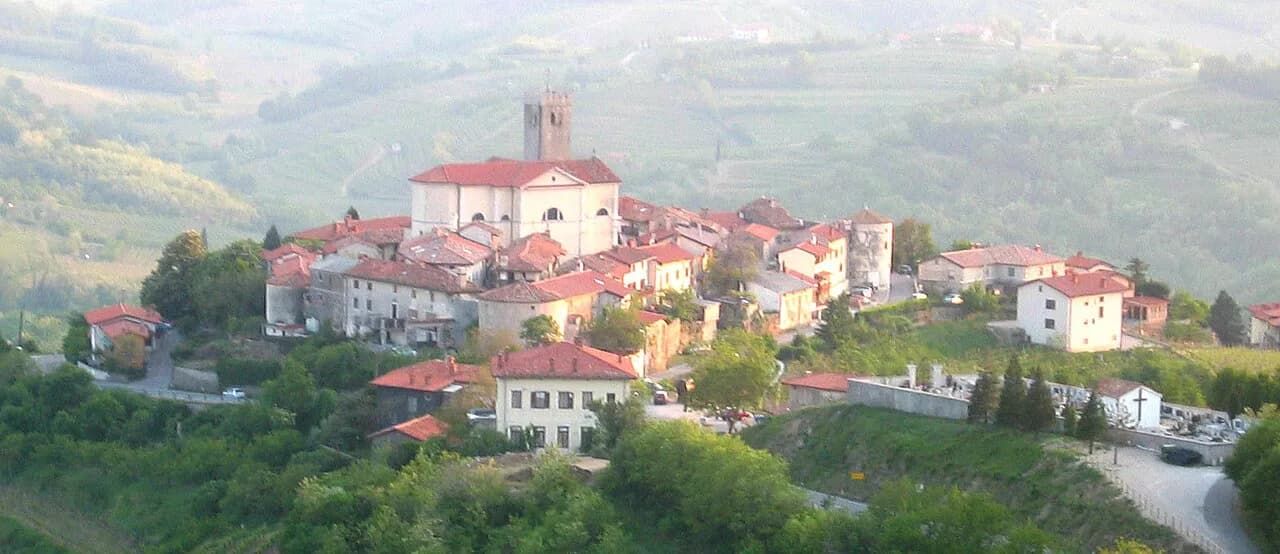
Gorizia, on the Italian side of the border, belongs to the same day as Nova Gorica, since the two form one cross-border urban area. If you want the Brda hills as well, give them their own day; the villages there, including Šmartno, Slovenia, reward a slow circuit and do not combine well with a valley drive.
What to skip when time is short
With one afternoon, skip both hill detours. Otliško okno and Nanos each eat half a day once you account for the climb and the descent, and neither leaves time for the towns. Drop Rihemberk as well: the castle is a proper excursion at the eastern end, not a quick look.
What you keep is the middle of the line: Vipava's springs and square, then Vipavski Križ, then Ajdovščina if there is still light. That is a coherent valley visit rather than a checklist of things you glimpsed.
Practical points: roads, parking, and checking current details
Minor roads carry light traffic and distances between the towns are moderate, which is why the valley suits a car or a bike rather than a single base with day trips. Park in the towns and walk; the centers are compact and the springs, walls, and squares are all on foot. For trail descriptions and points of interest along the way, the valley's tourism portal runs a web app with selected cycling and hiking routes.
Access to the castle and the fort, guided tour slots, and any local charges are best confirmed with the tourism portal before you set out, since arrangements change by season. That is a quick check, not a research project.
Which stops anchor your Vipava day
Anchor a first visit on Vipava and Vipavski Križ: the springs, channels, square, and walled village are close together and give the clearest sense of the valley in half a day. Add Ajdovščina and Rihemberk only if you have the full day and are driving the line west to east.
Save Otliško okno or Nanos for a day when the hill is the point of the trip. Gorizia across the border and the Brda hills beyond belong to a longer stay rather than a single drive.
Frequently Asked Questions
Can you visit the Vipava Valley without a car?
Partly. A train from Ljubljana ends at Nova Gorica, so the western end of the valley is reachable by rail, but Vipava, Ajdovščina, and Branik are not on that line. From Nova Gorica you need a bus, taxi, bike, or a booked transfer to reach the middle towns, and the valley's tourism portal lists transfer and shuttle services.
How long does the walk to Otliško okno take?
Allow around 90 minutes to walk up from Ajdovščina on the marked trail, as a walking estimate. From the window you can continue to a mountain guesthouse for lunch, which turns the outing into a half day.
Is Rihemberk Castle a quick stop?
No. It sits on a hilltop above Branik with the tallest tower in Slovenia, and reaching it involves a climb from the village, so treat it as the eastern anchor of a full day rather than a drive-by. Confirm current access with the valley's tourism portal.
What should you skip if you only have an afternoon?
Skip both hill detours and the castle. Otliško okno and Nanos each take about half a day for the climb and descent, and Rihemberk sits at the far eastern end. Spend the afternoon on Vipava, Vipavski Križ, and Ajdovščina instead.
Sources
- How to spend five days in Slovenia's Vipava Valley | National Geographic
- Vipava Valley | Official tourist web portal | Vipava Valley | Official tourist web portal
- Vipava Valley: Slovenia’s beautiful hidden treasure | CNN
- Vipava Valley, gastronomy, wine, cuisine, dishes, fruits, activities, hiking, cycling, climbing, adrenalin, paragliding, fishing, family | I feel Slovenia
Notes for your Slovenia trip
Optional updates to our Slovenia place guides.
You might also like
Continue reading
More guides you'll find useful