Slovenian Rivers: The Soča, Sava, Ljubljanica and What Each Is Like
Slovenian rivers range from the emerald Soča to the Ljubljanica, which resurfaces through the Karst. Here is what each river is like and where you meet it.
On this page
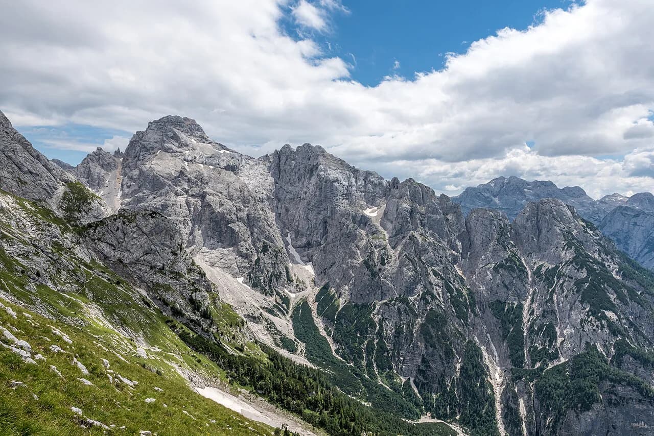
For a short trip, four rivers carry most of the reason to plan around water: the Soča in the Julian Alps, the Ljubljanica as it leaves the Karst, the Sava with its Bohinj and Dolinka branches, and the short, cave-fed Unica. Each one asks something different of you, whether that is a day in the mountains or a stop at a spring where a river reappears. This guide sorts the main Slovenian rivers by what they look like and where a visitor actually stands beside them.
The useful distinction is between rivers you can follow overland and rivers that vanish into limestone and surface somewhere else under a fresh name. That second group is why a single stream can be signed as the Ljubljanica in one valley and described under a different name a few ridges away. Length figures below come from the cited sources and are given as published, not averaged into one number.
Which Slovenian rivers matter most for a short trip
Start with the Soča if you are heading to Bovec, Kobarid or Tolmin, and with the Ljubljanica if your route passes the Karst or Planina Cave. The Sava Bohinjka belongs to a Lake Bohinj itinerary, and the Unica is a short, specific stop tied to Planina. Other Slovenian rivers are worth knowing by name even if you only cross them.
Sizing the rivers up by length helps you decide how much of one a short trip can cover. The OpenStreetMap waterway list gives the Sava at 836 kilometers, the Drava at 562, the Krka at 90, the Ljubljanica at 36 and the Unica at 17. The Soča appears there twice, at 93 and 22 kilometers, and a Slovenian tour operator describes it as running 138 kilometers from the Julian Alps to Italy.
A long river on paper is not a long river on your itinerary. Pick one stretch, such as the Soča around Kobarid and Tolmin or the Ljubljanica at its Karst springs, and accept that the rest stays unseen. That trade-off is what makes a two- or three-day plan workable.
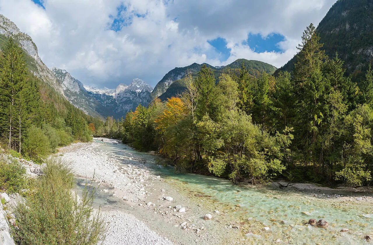
The Soča: emerald water in the Julian Alps and what people do on it
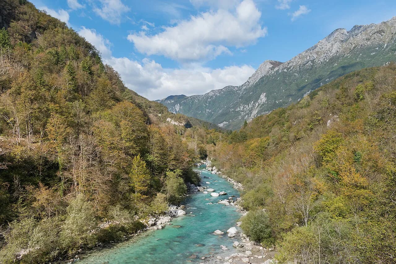
The Soča is the river most visitors picture when they think of Slovenian water. A Slovenian tour operator calls it the Emerald Queen of Slovenian Rivers and attributes its color to clear water over pure limestone bedrock, running from the heart of the Julian Alps down to the Karst. That description matches what you see around Bovec and Kobarid, where the river runs through gorges and open gravel banks.
The same operator lists kayaking, rafting and fly-fishing as the activities the river supports, and notes that it crosses into Italy along its course. Rafting and kayaking trips are run commercially in the upper valley, but operator prices and departure times are not something you should assume. Book through an operator in Bovec or Kobarid and confirm the details with them directly.
The Soča also carries a wartime history: the operator describes its valley as front-line ground in the First World War, the setting Hemingway later used in A Farewell to Arms. That context is useful when you pass the outdoor museums and memorials along the valley, which sit beside the water rather than apart from it.
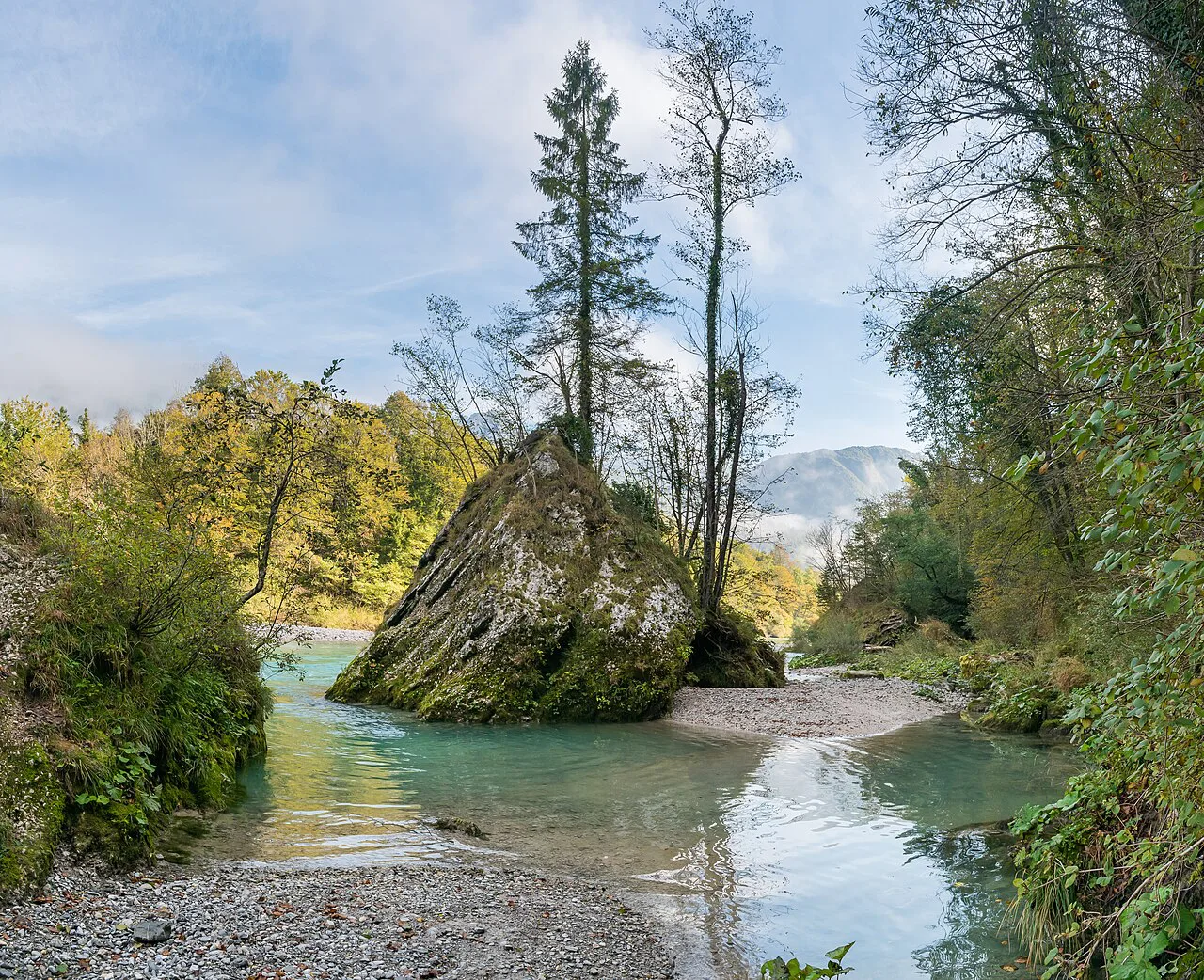
The Ljubljanica and the River of Seven Names: a river that disappears and resurfaces through the Karst
The Ljubljanica is the last above-ground stretch of a system that Slovenian hosts at Lipizzaner Lodge call the River of Seven Names, because the water surfaces under a new name each time it reappears. According to that account, the Ljubljanica flowing through the center of Ljubljana is the final section of the same flow. The waterway list gives the Ljubljanica a length of 36 kilometers.
The same account traces the flow across the Croatian-Slovenian border at Babno Polje and through the Green Karst, where it feeds disappearing lakes and passes between the stone arches of Rakov Škocjan nature park. At Planina Cave it joins another river and emerges as the Unica, which the waterway list puts at 17 kilometers. Snežnik Castle stands close to the Little Obrh, one of the upper sections.
For a traveler, this means choosing which appearance of the river you want to see rather than trying to follow the whole thing. Planina Cave and the Unica spring are the fixed Karst stop, and they fit a Karst day; Ljubljana works only as the last chapter. Lipizzaner Lodge notes that the number of above-ground sections visible depends on recent weather and the time of year, while the sinkholes and cave mouths can always be seen.
There is a separate Reka, whose name literally means river in Slovene, and it is not the same water. The Reka runs 54 kilometers in total, 51 of them in Slovenia, and flows through western Slovenia. The name overlap is a good reason to check a map rather than a signpost before you set out.
The Sava and its Bohinj and Dolinka branches
The Sava is the longest river on the waterway list at 836 kilometers, and its two headwater branches are the ones a visitor is most likely to meet. The Sava Bohinjka, at 31 kilometers, drains the Lake Bohinj side, while the Sava Dolinka, at 42 kilometers, comes down past Kranjska Gora. Both feed the main Sava, which carries on toward Croatia and eventually the Black Sea.
The Sava Bohinjka is the natural companion to a Lake Bohinj day, running out of the lake's eastern end near Ribčev Laz and past Stara Fužina. Treat it as scenery on the way to the lake rather than a separate destination, and you will use your time well. The upper Sava Dolinka makes a similar easy stop on the road through Kranjska Gora.
The Krka, Kolpa, Drava and other rivers worth knowing by name
Several more rivers reward a detour if your route already passes them. The Krka runs 90 kilometers, the Drava 562, the Idrijca 56 and the Vipava 44, according to the waterway list. The Krka passes Novo Mesto, the Drava runs through Maribor and Ptuj, and the Idrijca belongs to the Idrija valley.
The east and southeast add a few more names. The Kupa runs 287 kilometers according to the waterway list, and the Lahinja, at 35 kilometers, belongs to the same southeastern corner. None of these need a dedicated trip, but they give shape to a drive across the region.
In the west, the Idrijca runs 56 kilometers according to the waterway list and belongs to the Idrija valley. Use it as a marker on a map rather than a destination in itself unless you are already in the area.
Marble trout and fly fishing on the Soča
The Soča is known for marble trout, a native fish that fly fishers travel for. A Slovenian fly-fishing gallery labels the river one of the best rivers for fly fishing in Slovenia and shows marble trout from the upper Soča valley. The same gallery notes grayling as well, and its images come from the upper, middle and Trenta valley sections.
The practical step for fishing these trout waters is to arrange a permit and a guide or day ticket through a licensed operator in Bovec, Kobarid or Tolmin before you travel, rather than assuming you can cast from any bank. Confirm permit costs and season dates with the operator you book through.
If you are not fishing, the trout still matter: the river's reputation for clear, cold water is why the valley fills with anglers in the warmer months. Expect company on the classic pools in July and August and quieter banks in spring and autumn.
How the Karst geology shapes where you can actually see these rivers
Much of Slovenia's water runs through limestone rather than over it, and the Lipizzaner Lodge account describes that underground country as central to the River of Seven Names. Caves, sinkholes and disappearing lakes are the visible parts of a system whose connections are not fully mapped. What you can see above ground depends on where the rock lets the water out.
This is why a Karst itinerary reads differently from an Alpine one. Around Bled and Bohinj the water stays put and you plan around a lake shore; on the Karst you plan around a spring, a cave mouth or a polje that may hold water or not. Rakov Škocjan, Planina Cave and the Unica spring are the fixed points worth building a day around.
Reading the water: color, limestone bedrock and snowmelt
The color visitors come for comes from suspended limestone particles and the clarity of snowmelt-fed water. The Slovenian tour operator attributes the Soča's emerald-turquoise tone to its crystal-clear character and the pure limestone bedrock it runs over. The same limestone is what makes the water disappear underground elsewhere.
Color shifts with the season and with rainfall upstream, so treat any photograph as a possibility rather than a promise. Spring snowmelt runs high and fast, late summer runs lower and clearer, and a summer storm can turn a clear river gray within hours. Water temperature and level are not something you can plan from a guide; check locally on the day.
Practical constraints: seasonal water levels and above-ground sections that come and go
The biggest planning constraint on Slovenian rivers is that some sections are only above ground part of the year. Lipizzaner Lodge notes that recent weather and the season decide how many parts of the River of Seven Names you can see overland, while the dry or wet sinkholes and caves are always visible. In summer, parts of the river bed can be walked.
Along the Soča, water levels affect what rafting and kayaking operators can run on any given day, so a confirmed booking is not the same as a guaranteed descent. Build a flexible day and keep a valley walk or a cave visit as a backup. On the Karst, the backups are easy: Planina Cave, Rakov Škocjan and the Unica spring are all within a short drive of each other.
If your priority is a particular above-ground stretch of the Ljubljanica system, check with the local tourist office or the cave management at Planina before you drive out. They know whether the water is running where you want to see it. Everywhere else, a river you can stand beside is a river you can plan around.
Which river should anchor your trip?
Choose the Soča if you want mountains, gorges and a river you can follow for a whole day around Bovec, Kobarid and Tolmin. Choose the Ljubljanica system if the Karst and its caves are already on your list, and build the day around Planina Cave, Rakov Škocjan and the Unica spring. Choose the Sava Bohinjka if Lake Bohinj is your base, and treat the rest as rivers you cross on the way.
Whichever you pick, the pattern is the same: one stretch, seen properly, beats a checklist of rivers seen from a car window. Confirm water levels, permits and any cave access with the operator or local office before the day, and leave room for the weather to change the plan.
Explore more Slovenia guides
Sources
Notes for your Slovenia trip
Optional updates to our Slovenia place guides.
You might also like
Continue reading
More guides you'll find useful